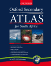
A completely new atlas based on the most up-to-date data available.
Features
- Thorough coverage of curricula meets all learners needs in Senior Phase and FET Geography classes.
- Exceptionally clear maps, text, and layout make all the data easy to read and interpret.
- Brand-new South Africa maps show all the latest place names and changed provincial boundaries.
- Map skills are explained with clear examples, enabling learners to use the atlas with ease and confidence.
- Over 50 photographs and satellite images enhance and clarify the maps.
- Outstanding wall maps for your classroom.
- Coverage of topical issues such as climate change globalization, HIV/Aids and the worlds top tourist destinations ensure that geography is kept interesting and relevant.
- A fascinating six page data section gives the population and statistics for economics and quality of life (or development) in 170 countries.
- Based on careful research with teachers to provide the maps and data that learners really need.
- The Teachers Resource Books and Workbooks provide support for teaching and a ssessment plus activity pages which can photocopied to save you time and give learners exam practice.


